
Map of Bangladesh and its neighboring countries
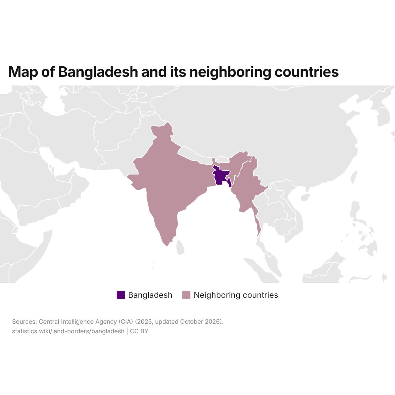
Bangladesh borders two countries: India and Myanmar. Bangladesh's land borders total 2,742 mi (4,413 km), the 43rd longest of the 157 countries with land borders.
Bangladesh's land borders are the 14th longest of the 41 countries of Asia with land borders.
Bangladesh land borders: total length, rankings and longest border
| Total length | 2,742 mi (4,413 km) |
|---|---|
| Neighboring countries | 2 |
| World rank by total length | 43/157 |
| Rank in Asia | 14/41 |
| Rank, lower-middle income | 15/42 |
| Longest border |
 India 2,574 mi (4,142 km) |
Bangladesh neighboring countries and border lengths
| Neighboring country | Border length, mi | Share of the total | |
|---|---|---|---|
|
India
|
2,574 | 93.9% | vs India |
 Myanmar |
168.4 | 6.14% | vs Myanmar |
The border with India is the longest, 2,574 mi (4,142 km), 93.9% of the total; the shortest, with Myanmar, is 168.4 mi (271 km).
Bangladesh and nearby countries: total length of land borders
Of Bangladesh and the five nearby countries, India has the longest land borders in total, 8,630 mi (13,888 km), and Bhutan the shortest, 706 mi (1,136 km). Bangladesh is fourth of the six, with 2,742 mi (4,413 km).
Compare the land borders of Bangladesh with other countries
Sources:
- Central Intelligence Agency (CIA) (2025, updated October 2026)
Creative Commons Attribution (CC BY): you may copy, share, adapt and reuse this content, also commercially, as long as you credit statistics.wiki and note any changes you made. The sources listed above may have their own license terms.